AllTrails Review 2026: Is Plus or Peak Worth Paying For?
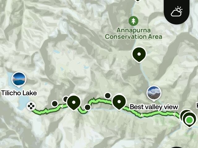
When we compare AllTrails’ subscription plans, we focus on one question: does paying for the app make a real difference to my hiking experience? AllTrails offers three options: a free plan, Plus for $35.99 per year, and Peak for $79.99 per year. After reviewing its membership pages, launch announcements, and independent reviews, our conclusion is that most hikers can get by with the free version or Plus. Peak makes more sense for people who regularly head into remote areas or need more advanced navigation tools.
AllTrails lists more than 500,000 trails worldwide and reported over 80 million registered users when it launched Peak in 2025. That scale is the actual product. Almost every trail comes with recent reviews, photos and condition notes from people who walked it days ago, which a printed guidebook can’t match. What changes between the tiers is mostly what happens when your phone loses signal.
How we researched this: We did not field-test every tier ourselves. This guide is built from AllTrails’ official membership documentation and press releases, plus independent reviews published in 2025 and 2026. Where sources disagree, we say so. Prices are US dollar list prices; euro prices in the App Store or Google Play can differ, so check the app before you buy.
The short answer
- Free: enough for day hikes where you have mobile signal.
- Plus ($35.99/year): the sensible upgrade for anyone who hikes in valleys, forests or mountains with patchy coverage.
- Peak ($79.99/year): only worth it if you build your own routes or want forecast data along the trail itself.
AllTrails Free vs Plus vs Peak at a glance
| Feature | Free | Plus | Peak |
|---|---|---|---|
| US price per year | $0 | $35.99 | $79.99 |
| Trail search, filters, maps, reviews | Yes | Yes | Yes |
| 500,000+ mapped viewpoints and amenities | Yes | Yes | Yes |
| GPS navigation and activity recording | Yes | Yes | Yes |
| Offline trails, parks and custom areas | No | Yes | Yes |
| Wrong-turn alerts | No | Yes | Yes |
| 3D trail preview | No | Yes | Yes |
| Live sharing of your location | No | Yes | Yes |
| Ad-free | No | Yes | Yes |
| Custom routes in the app | No | No | Yes |
| Smart-routing (shorter, less steep, more scenic) | No | No | Yes |
| Trail Conditions along the route* | No | No | Yes |
| Outdoor Lens plant identification | No | No | Yes |
| Community heatmaps | No | No | Yes |
*Trail Conditions launched as a Peak feature. At least one reviewer reports it has since moved into Plus, so check AllTrails’ current membership page before deciding on that feature alone.
AllTrails review: what the free version actually gets you
The free tier is better than the word “freemium” suggests. You get trail search with filters for length, difficulty and traffic, maps, community reviews with photos, and GPS recording. Since the 2025 summer update, every member can also see more than 500,000 mapped viewpoints, landmarks and trail amenities.
The reviews are where the real value sits. A typical thread tells you things no official trail description mentions: where the car park fills up, whether a stream crossing is passable after rain, which junction people keep missing. For finding a hike and judging it before you drive to the trailhead, the free version does the job.
The limit is signal. Without offline downloads, the map stops loading once you lose coverage, and the free tier has no fallback for that. One workaround costs nothing: screenshot the route map and the elevation profile at home. The GPS dot won’t show on a screenshot, so treat it as an orientation backup, not as navigation.
AllTrails Plus: the upgrade most hikers should consider
Plus is built around one problem, being somewhere without reception. It lets you download offline maps in three ways: a single trail, an entire park with every trail in it, or a custom area you draw yourself. The custom areas arrived with the 2025 summer update and come with high-resolution maps and details for each trail inside.
Next to offline maps, the feature people mention most is the wrong-turn alert. If you drift off the route, the phone buzzes. It sounds minor until you’ve spent twenty minutes following the wrong fork in a forest with five identical-looking paths. Plus also adds 3D trail previews, live sharing so someone at home can follow your progress, and removes ads.
At $35.99 a year, that’s roughly $3 a month. Reviewers also mention that AllTrails runs sales of up to 50% off from time to time, so check before paying list price.
Where Plus disappoints: the alerts and offline maps are only as good as the track underneath them. AllTrails trails are crowd-sourced, and wrong trail data is a recurring theme in one-star reviews of hiking apps in general. If a user-uploaded track cuts a corner or follows a closed path, the app will happily guide you along it. Cross-check against trail markings and the park’s own map. Also download your maps on home Wi-Fi, not at the trailhead.
AllTrails Peak: powerful, but for a narrow group
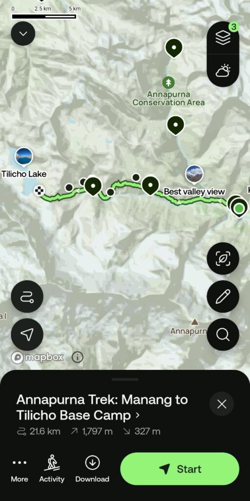
Peak includes everything in Plus and adds planning tools. The main one is custom routing. Until Peak, route building was mostly a website feature; now you can start from scratch or edit an existing trail in the app and download the result. Smart-routing can make a route shorter, less steep or more scenic with a tap.
The second headline feature is Trail Conditions, a forecast along the trail rather than at the nearest town. It covers temperature, rainfall and snow depth, with alerts for air quality and mosquito activity. That’s useful on a ridge route where the trailhead and the summit sit in different weather. Peak also adds Outdoor Lens, which identifies trees, plants and flowers through your camera, and community heatmaps showing where other members actually walk.
Where Peak disappoints: it costs $44 more per year than Plus, and nearly all of what it adds is planning. If you mostly follow trails other people have already published, you will use very little of it. A phone weather app plus a decent forecast covers much of what Trail Conditions does, as one reviewer pointed out; the custom routes and heatmaps are the two things you can’t easily replace.
Where AllTrails falls short
No review of AllTrails is honest without these:
- Offline maps are paywalled. There is no free offline option, and for many hikers that is the entire reason to pay.
- Difficulty ratings are generic. They are written for a broad audience, so a trail rated “moderate” can still be hard for you. Read the distance and elevation gain yourself and compare them with hikes you’ve done.
- Map detail thins out in remote terrain. The basemap is derived from OpenStreetMap, which is excellent on popular routes and sparse deep in the backcountry. For off-trail navigation, topo-focused apps do better.
- Battery drain. Recording with the screen on is hard on a phone battery, and hiking apps with GPS recording and active map layers get this complaint across the board.
- Best for known trails. The app is strongest at finding and following established trails, not at inventing your own line across open country.
Using AllTrails in Europe
AllTrails is available in German, French, Spanish and Italian, among other languages, and popular European routes are covered. The honest caveat is that its data is deepest in North America, and several comparisons rank it first for North American trail discovery. Coverage thins out as you move away from established parks and busy routes, since the map quality depends on how much community data exists for a given area.
In practice, we’d use AllTrails in Europe for discovery and for the reviews, then confirm the route against local waymarking and the regional hiking map. If you plan trails in Portugal, Spain, Croatia or Italy, our hiking trail guides list the practical details that the app’s data often skips.
AllTrails vs Komoot, Gaia GPS and onX Backcountry
| App | Best at | Weak spot | How you pay |
|---|---|---|---|
| AllTrails | Finding trails, reviews, beginner-friendly interface | Offline maps paywalled; thin in remote areas | Annual subscription (Plus, Peak) |
| Komoot | Route planning, strong European coverage | Costs add up if you hike in many regions | One free region, then one-time regional packs or a world pack |
| Gaia GPS | Detailed topo layers for off-trail navigation | Minimal community layer, more technical to use | Annual subscription, priced above AllTrails Plus |
| onX Backcountry | Public and private land boundaries | Content skews to the US | Annual subscription |
Many experienced hikers run two apps: AllTrails to find a trail and read recent conditions, and a topo-focused app such as Gaia GPS to navigate once they leave the marked path. If every hike you plan this year is on a signed, maintained trail, AllTrails alone is enough and a second subscription is wasted money.
What to carry besides the app
A hiking app is a phone app, and phones fail: cold drains batteries, screens crack, signal disappears. Pair it with a few cheap backups:
- A power bank. A 10,000 mAh model typically gives a modern phone about two full charges in real use, which covers a long day with GPS recording.
- A paper map and a compass for the area, and the ability to read them.
- A pre-downloaded offline map (Plus or Peak) rather than a plan to download on the trail.
Our safety guides cover what else belongs in the pack, and our tech section has the electronics worth carrying.
Which AllTrails plan should you choose?
- You do day hikes near home with good signal: stay on Free and screenshot your route.
- You hike in mountains, forests or abroad, or you go alone: Plus. Offline maps and wrong-turn alerts are the two features that change what happens when things go wrong.
- You design your own loops, link trails together or plan multi-day routes: Peak, and only then.
- You’re unsure: start with Plus and upgrade later if you keep wishing you could edit routes.
AllTrails FAQ
Is AllTrails free?
Yes. The free Base tier includes trail search, maps, reviews and GPS recording. Offline maps, wrong-turn alerts and 3D previews need Plus ($35.99 per year in the US), and custom routes need Peak ($79.99 per year).
Does AllTrails work without signal?
Only if you downloaded the map beforehand. Offline trails, parks and custom areas are available with Plus and Peak.
What is the difference between AllTrails Plus and Peak?
Plus covers navigation safety: offline maps, wrong-turn alerts, 3D previews and live sharing. Peak adds planning tools on top: custom and smart-routed trails, Trail Conditions, Outdoor Lens and community heatmaps.
Is AllTrails accurate?
Mostly, on popular trails, but the data is crowd-sourced and errors exist. Check distance and elevation gain yourself, read the latest reviews, and compare the track with trail markings.
Is AllTrails good in Europe?
It works for discovery and reviews on popular routes, but coverage thins away from busy parks. Komoot is the stronger choice for route planning across Europe.
Is AllTrails Plus worth $35.99?
If you ever hike without signal, yes: that’s about $3 a month for offline maps and wrong-turn alerts. If you only hike where your phone has full bars, the free version does the same job.
Verdict
AllTrails remains the easiest way to find a good hike and see what the last ten people thought of it. Take the free version for that. Pay for Plus when your hikes leave mobile coverage, because offline maps are the one feature with real safety value. Skip Peak unless you plan your own routes, and don’t treat any app as a substitute for a paper map and a charged power bank.