8 Best Offline Gps Apps for Hiking Navigation in 2026
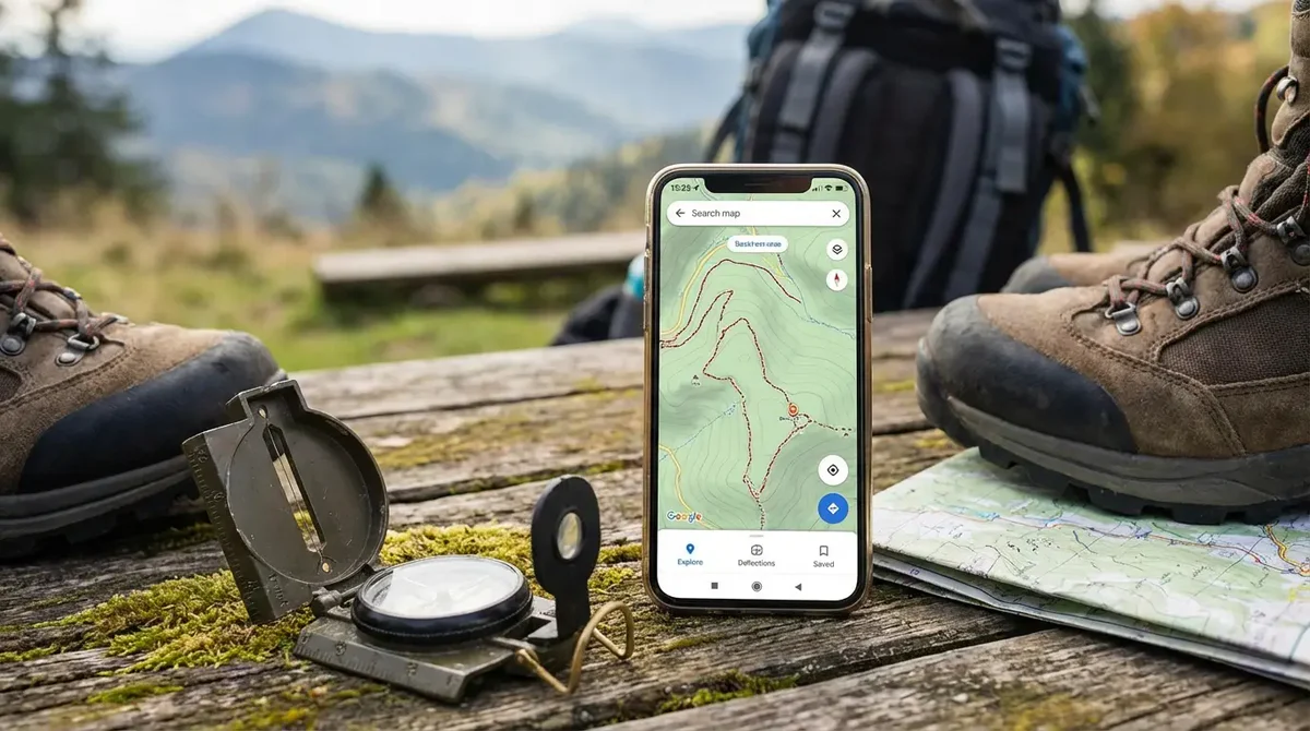
Getting lost on a trail is every hiker’s worst fear, and relying on mobile signal alone can leave you stranded without directions when you need them most. Offline GPS apps for hiking navigation solve this problem by letting you access detailed maps and track your route without cell service. These tools give you confidence on unfamiliar terrain and help ensure you stay on course, even in remote areas.
This guide walks through the best offline GPS apps for hiking navigation and why they stand out for outdoor use. We cover key features like map quality, ease of use, battery efficiency, and unique tools that enhance your navigation experience. By the end, you’ll have a clear understanding of which apps will keep you oriented and confident on your next hike.
1. Us Topo Maps
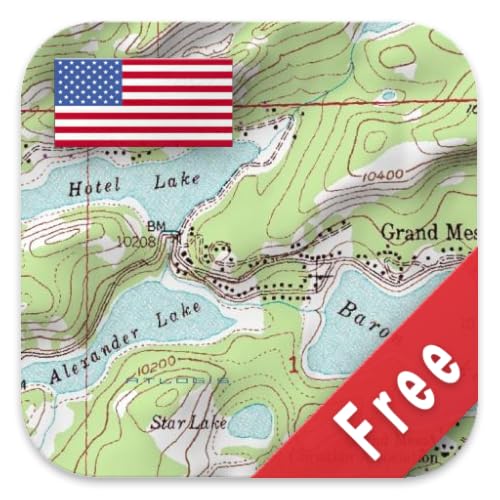
US Topo Maps Free is an excellent choice for outdoor enthusiasts, hikers, campers, and anyone needing detailed and reliable topographic maps of the United States. Ideal for those who require accurate terrain information without incurring additional costs, this product is perfect for both professionals and casual users who want to explore the outdoors with confidence.
Pros:
- Completely free access to detailed topographic maps
- Produced by ATLOGIS Geoinformatics GmbH & Co. KG, ensuring high-quality and accuracy
- Easy to use and download for offline access
- Supports a wide range of outdoor activities with clear elevation contours and landscape features
Cons:
- Limited to maps of the United States only
- May lack advanced features found in paid mapping software
- Some users might find the interface less intuitive compared to commercial apps
The US Topo Maps Free product by ATLOGIS Geoinformatics GmbH & Co. KG offers comprehensive and detailed geographic data that is essential for anyone navigating the outdoors. Its high-quality topographic details, including elevation lines, water bodies, and landmarks, provide users with critical information to plan routes and understand the terrain better. Because it is free, it removes the barrier of cost, making professional-grade maps accessible to a wider audience.
Additionally, the ability to download and use maps offline is a significant benefit for those venturing into remote areas without reliable internet access. The detailed and accurate data helps users stay safe and oriented, enhancing their overall outdoor experience. While it may not have all the bells and whistles of paid software, its core functionality meets the essential needs of hikers, campers, and explorers looking for dependable US topographic maps.
To buy this product, click here.
2. Osmand

The OsmAnd — Offline Travel Maps & Navigation app is ideal for travelers, hikers, and outdoor enthusiasts who require reliable offline map access and navigation without depending on an internet connection. It is perfect for those who explore remote areas or travel internationally where mobile data may be expensive or unavailable. Users who value detailed customizable maps and turn-by-turn voice guidance will find this app highly beneficial.
Pros:
- Provides comprehensive offline maps with no need for internet connectivity
- Highly customizable navigation options including voice guidance and route planning
- Supports multiple outdoor activities such as hiking, cycling, and driving
- Regular map updates and open-source based data ensure accuracy
- Allows saving favorite locations and creating custom routes
Cons:
- Initial setup and map downloads can consume considerable device storage
- Some advanced features require in-app purchases or subscriptions
- User interface may have a learning curve for beginners
OsmAnd offers a rich set of features designed to enhance the travel experience by providing detailed offline maps that cover a wide range of geographical areas. The app uses open-source map data to deliver up-to-date information, which is crucial for users navigating unfamiliar territories without relying on internet access. Its flexible navigation options, including voice prompts and customizable routes, allow users to tailor their journeys to their preferences and needs.
Additionally, the app supports multiple modes of transportation and activities, making it versatile for various types of users—from casual tourists to serious adventurers. The ability to save favorite spots and create personalized routes adds convenience and helps users organize their trips efficiently. While some features are locked behind premium versions, the core functionality provides substantial value for offline travel and exploration.
To buy this product, click here.
3. Better Maps

The Better Maps app is ideal for travelers, commuters, and outdoor enthusiasts who need reliable and detailed GPS navigation with the added convenience of offline maps. If you often find yourself in areas with limited internet access or simply want more comprehensive location information, this tool from WeLoveMaps is designed to enhance your navigation experience.
Pros:
- Accurate and detailed GPS navigation for seamless travel.
- Access to extensive location info to help discover new places.
- Ability to use offline maps ensuring navigation without internet connectivity.
- Developed and supported by the trusted WeLoveMaps brand and manufacturer.
Cons:
- May require significant storage space for downloading offline maps.
- Some advanced features may have a learning curve for new users.
The Better Maps app stands out by combining detailed GPS navigation with rich location info, making it easier for users to explore unfamiliar areas confidently. The integration of offline maps ensures that users remain connected to navigation services even when they encounter poor or no internet connectivity, a crucial feature for travelers in remote locations. The app’s user-friendly interface enhances accessibility, allowing quick access to vital navigation tools and information.
Developed by WeLoveMaps, this app benefits from the expertise and support of a dedicated team focused on improving map accuracy and user experience. Whether you’re planning a road trip, hiking in the wilderness, or navigating city streets, the comprehensive features of Better Maps provide reliable guidance and detailed insights, helping users save time and avoid frustration.
To buy this product, click here.
4. Routeme Latvia

The RouteMe Latvia: Offline GPS Navigation & Map is ideal for travelers, drivers, hikers, and anyone exploring Latvia who needs reliable navigation without relying on an internet connection. Whether you are adventuring in remote areas or navigating busy city streets, this app suits users who want accurate, turn-by-turn directions and real-time location tracking on their mobile devices.
Pros:
- Works completely offline, saving data and ensuring navigation without internet.
- Turn-by-turn directions provide clear and easy-to-follow routes for drivers and hikers.
- Real-time location tracking helps users know their exact position on the map at all times.
- Designed specifically for Latvia, offering detailed and localized maps.
- Suitable for various activities such as traveling, driving, hiking, and road navigation.
Cons:
- Limited to maps and navigation within Latvia, not useful for other countries.
- Some advanced features may require occasional internet access for updates.
- Dependent on device GPS accuracy, which may vary by smartphone model.
Developed by Applab Studios, this app offers a seamless experience for users needing dependable offline navigation. Its detailed maps and intuitive interface allow travelers and locals alike to explore Latvia confidently without worrying about losing signal or incurring roaming charges. The combination of offline functionality and real-time location updates makes it a practical tool for diverse navigation needs.
Additionally, the app’s turn-by-turn directions reduce the stress of finding your way, especially in unfamiliar or rural areas. Whether hiking through nature trails or driving through city streets, users benefit from accurate route guidance and the convenience of having all navigation tools available on their device without requiring constant internet connection. This makes RouteMe Latvia a valuable companion for anyone visiting or living in Latvia.
To buy this product, click here.
5. Routeme Iceland

The RouteMe Iceland: Offline GPS Navigation & Map app is ideal for travelers, drivers, hikers, and road trip enthusiasts exploring Iceland who need reliable navigation without internet access. Whether you’re planning an adventurous hike, a scenic road trip, or simply want turn-by-turn directions while traveling in remote areas, this app is designed for users seeking seamless, offline GPS functionality and real-time location tracking.
Pros:
- Reliable offline GPS navigation with detailed maps of Iceland
- Turn-by-turn directions for easy route guidance
- Real-time location tracking without the need for internet connection
- Perfect for travel, driving, hiking, and road trips in remote areas
- Developed by trusted Applab Studios
Cons:
- Limited to coverage specifically for Iceland
- May require initial download of map data which can be large
- Advanced features might need occasional updates via internet
The RouteMe Iceland app stands out by offering comprehensive offline navigation capabilities, enabling users to explore Iceland’s vast landscapes without worrying about losing signal. Its detailed maps and intuitive interface ensure that users can easily plan routes and receive accurate turn-by-turn directions. This is especially beneficial for hikers and road trippers venturing into areas where internet access is unreliable or unavailable.
Additionally, the app’s ability to provide real-time location tracking offline means travelers can maintain situational awareness and navigate confidently. The convenience of having all necessary maps stored on the device reduces dependency on cellular data, making it a cost-effective and practical solution for extended trips. Designed by Applab Studios, the app combines functionality and user-friendly design tailored specifically for Iceland’s unique terrain and travel needs.
To buy this product, click here.
6. Locus Map 4

The Locus Map 4 – Navigation App is ideal for outdoor enthusiasts such as hikers, bikers, and geocaching fans who need a reliable and versatile navigation tool. If you often explore remote trails or engage in various outdoor activities, this app is designed to enhance your experience with detailed maps and robust tracking features. It is perfect for those who want to combine adventure with accurate navigation and safety.
Pros:
- Comprehensive offline maps for uninterrupted navigation
- Supports multiple outdoor activities including hiking, biking, and geocaching
- Advanced GPS tracking with customizable routes and waypoints
- User-friendly interface with detailed map layers and terrain data
- Regular updates from a reputable developer, Asamm Software, s.r.o.
Cons:
- Some advanced features require in-app purchases or subscriptions
- Initial learning curve for new users due to extensive functionality
- Performance may vary depending on device hardware capabilities
The Locus Map 4 boasts a variety of features tailored to outdoor adventurers. Its ability to provide offline maps means users can navigate even without cellular service, an essential benefit when exploring remote areas. The app supports multiple activities, allowing users to switch between hiking, biking, or geocaching modes seamlessly, which enhances versatility and convenience. Additionally, the customizable GPS tracking lets users create and follow personalized routes, improving navigation accuracy and trip planning.
Furthermore, the app offers an intuitive interface with detailed map layers including topographic and satellite views, helping users better understand the terrain and environment. This feature is particularly useful for safety and route optimization. Developed by Asamm Software, s.r.o., the app benefits from continuous updates and improvements, ensuring users have access to the latest features and bug fixes. Overall, Locus Map 4 provides a comprehensive and dependable navigation solution for anyone passionate about outdoor adventures.
To buy this product, click here.
7. Routeme Slovenia

The RouteMe Slovenia app is ideal for travelers, hikers, and drivers who want to explore Slovenia without relying on an internet connection. Whether you’re navigating city streets or remote hiking trails, this offline GPS navigation tool is perfect for adventurers seeking reliable and accurate directions without worrying about data usage or signal loss.
Pros:
- Comprehensive offline maps and routing for all of Slovenia
- Turn-by-turn directions to simplify navigation on foot or by vehicle
- GPS tracking functionality even without internet access
- Supports multiple activities including travel, hiking, driving, and city navigation
- Developed and maintained by the trusted Applab Studios
Cons:
- Limited to Slovenia and not suitable for broader international travel
- Potentially large storage space required for offline maps
- May lack real-time traffic updates due to offline usage
The RouteMe Slovenia app provides detailed and accurate offline maps, allowing users to navigate confidently without the need for internet connectivity. Its turn-by-turn directions enhance user experience by guiding travelers clearly whether they are driving through city streets or hiking in the countryside. This makes it particularly useful for those who want to avoid roaming charges or find themselves in areas with limited cellular coverage.
Furthermore, the app’s integrated GPS tracker ensures users can track their location precisely, improving safety and convenience during outdoor activities. The design supports multiple navigation modes, making it versatile for various types of excursions. Developed by Applab Studios, the app combines robust functionality with a user-friendly interface, making it a reliable companion for anyone exploring the beautiful landscapes of Slovenia.
To buy this product, click here.
8. Routeme Luxembourg

The RouteMe Luxembourg app is ideal for travelers, drivers, and hikers who want reliable offline GPS navigation and detailed maps of Luxembourg without depending on internet connectivity. If you plan to explore Luxembourg’s cities, countryside, or hiking trails where cellular service might be limited or costly, this app is designed to keep you on track and informed at all times.
Pros:
- Fully offline GPS navigation with no need for internet connection during use
- Detailed and accurate offline maps tailored specifically for Luxembourg
- GPS tracker functionality ideal for travel, driving, and hiking activities
- User-friendly interface developed by Applab Studios
- Efficient routing options to explore Luxembourg’s roads and trails easily
Cons:
- Limited to Luxembourg; not suitable for navigation outside this region
- May require initial download of large map files consuming storage space
- Some advanced features may need updates or in-app purchases
The RouteMe Luxembourg app offers an exceptional solution for navigating Luxembourg without the hassle of internet dependency. Its offline maps are comprehensive and designed to assist users in urban environments as well as remote hiking trails, ensuring travelers never lose their way. The built-in GPS tracking helps monitor your route in real-time, making it an excellent companion for drivers and outdoor enthusiasts alike.
Developed by Applab Studios, this app ensures a smooth and intuitive user experience with precise routing and map details. Whether you are driving through Luxembourg’s cities or hiking in the countryside, the app provides reliable directions and location tracking. Its ability to work fully offline eliminates roaming charges and connectivity worries, making it a smart choice for anyone exploring this beautiful country.
To buy this product, click here.
Frequently Asked Questions
What Are The Best Offline Gps Apps For Hiking?
Top offline GPS apps include US Topo Maps Free, OsmAnd, and Locus Map 4. These apps offer detailed maps, offline navigation, and route tracking perfect for hiking.
How Do Offline Gps Apps Work Without Internet?
Offline GPS apps download maps and data beforehand. They use your device’s GPS signal to track location without needing cellular data.
Can These Apps Provide Turn-by-turn Directions Offline?
Yes, apps like RouteMe Iceland and RouteMe Latvia offer turn-by-turn directions even without internet access, making navigation easier during hiking or travel.
Are These Apps Suitable For International Hiking Trips?
Absolutely. Apps like OsmAnd and RouteMe series support maps for various countries, ideal for hiking in unfamiliar international locations.
Which App Offers The Most Detailed Topographic Maps?
US Topo Maps Free specializes in detailed topographic maps. It’s great for hikers needing elevation and terrain information offline.
Can These Apps Track My Hiking Route And Location In Real-time?
Yes, many apps like Locus Map 4 and RouteMe Luxembourg provide real-time location tracking and GPS route logging during hikes.
Conclusion
Choosing the right offline GPS app can make your hiking trips safer and more enjoyable. Each app offers unique features like detailed maps, turn-by-turn directions, and real-time location tracking. US Topo Maps Free and OsmAnd provide extensive map coverage without internet access.
Apps like RouteMe offer specialized maps for regions like Latvia, Iceland, Slovenia, and Luxembourg, perfect for exploring these areas offline. Locus Map 4 supports various outdoor activities, including biking and geocaching. Using these apps ensures you stay on track, even in remote places without signal.
Remember, always download maps before your trip and test the app to understand its functions. With the right offline GPS app, you can hike confidently and focus on the beauty around you. Safe travels and happy hiking!